
The ocean covers 71% of the Earth's surface area and connects ports worldwide, making maritime transportation the primary mode of international logistics and a cornerstone of global trade. Shipping efficiently transports goods, especially for bulk goods and long-distance transportation, to destinations worldwide. However, maritime navigation faces challenges due to unpredictable weather conditions such as fog, strong winds, and rough seas. Additionally, communication between ships and land is greatly restricted during ocean voyages, leading to delays in information transmission and posing threats to both personnel and cargo safety.

The client is a well-known shipping company operating a global network with shipping, ports, and logistics as its core industries. Currently, the client is seeking to digitize and greenify its shipping and logistics services, aiming to reduce equipment wear and maintenance costs. Before using ONERugged's products, the client's old maritime equipment could only provide limited positioning functionality and could not display image/video or transmit real-time communication data. Due to the insufficiently rugged and compact design of the consumer-grade equipment, it lacked ideal waterproof and shockproof performance to withstand the impact and collision of waves. As a result, the equipment was prone to malfunction and interruption of operations after exposure to water or collisions. In emergency situations at sea, crew members need to react quickly. However, traditional communication devices or damaged equipment may not provide timely and accurate location information, making emergency response difficult. Additionally, to maintain long-term route guidance, the equipment not only requires sufficient battery life but also demands high screen brightness to ensure clear display of information under intense sunlight outdoors. Therefore, a smart device with a rugged body and precise positioning coupled with a high-definition display is crucial for the client's smooth sailing.
The ONERugged M10A rugged mobile PC stands out among various reinforced device manufacturers with its outstanding durability and reliable performance, making it the efficient solution for our client's maritime transportation needs. It guides vessels along the optimal sailing routes, ensuring smooth navigation.

Solution of M10A
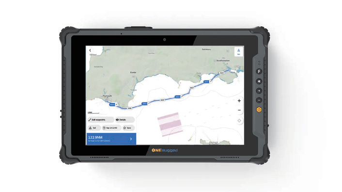
The M10A rugged mobile PC, with its 10.1-inch compact size, is perfectly suited for easy carrying by crew members on board. Its high-definition, high-brightness screen ensures visibility even in direct sunlight, effectively providing crew members with an easily readable electronic map. Even on vast, pitch-black nights, the tablet displays navigation routes, positions, and hazard markers clearly. In the face of unpredictable maritime environments and weather, the M10A has proven its ability to resist water intrusion, impact, and extreme temperatures, providing the client and crew members with full confidence in its stable information output.
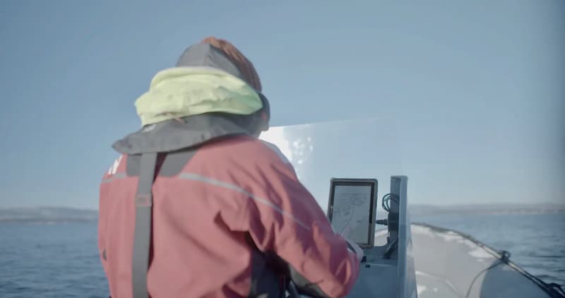
Before setting sail, the M10A can be securely held by crew members using carry handles or hand-straps, or securely mounted on the ship with a vehicle mount. With its user-friendly Windows 11 system, it can quickly run multiple software applications simultaneously. Once at sea, the M10A's built-in precise GPS module ensures stable display of the vessel's position and navigation route, unaffected by waves, providing accurate, clear, and timely navigation at all times. In emergency situations at sea, the tablet's high-definition front and rear cameras can capture photos or videos of any anomalies. Coupled with its wide range of network connectivity options including WiFi, 4G, and Bluetooth, it enables real-time communication with shore control centers or other vessels, allowing for immediate situational awareness and problem-solving.
Furthermore, the M10A can be used to collect data from various sensors on board, such as meteorological information and ocean data. Utilizing this data for analysis allows for weather and sea condition predictions, providing reliable support for safe navigation of the vessel.
The ONERugged M10A rugged mobile PC provides comprehensive protection that is unassailable, ensuring resistance to water and shock, and resilience against salt spray when facing harsh maritime weather conditions. This capability reduces equipment wear and tear, thereby lowering overall navigation costs. The M10A integrates GPS positioning and multi-network fusion, offering precise navigation guidance and real-time information transmission and communication. This aids vessels in reaching their destinations smoothly, significantly enhancing navigation safety and reducing the incidence of maritime accidents.
The M10A provides client’s vessels with exceptional durability and upgraded data readability experience. With its high-resolution, high-brightness screen of 700cd/㎡, it continuously displays all the information and data required by the crew. With clear images and important icons displayed at a glance, crew members can be informed of the route and maritime conditions at any time or in advance, reducing the possibility of navigation errors. This allows for efficient progress towards the destination, minimizing the time and economic losses caused by incorrect direction.
In the face of harsh maritime conditions including strong winds, rough seas, and extreme temperature changes, the M10A tablet remains unfazed and operates normally. It has passed rigorous U.S. military testing standards and a 1.22-meter drop test, achieving IP65 waterproof and dustproof performance. Even in temperatures ranging from -20°C to 60°C, it continues to provide timely information display and navigation for vessels. As a result, crew members can be assured of equipment reliability, reducing equipment wear and tear as well as the subsequent repair and purchasing costs, thereby lowering the overall cost of navigation.
During long-distance voyages, the M10A maintains connectivity with other vessels, crew members, or control centers through various network communication modules including the latest WiFi 6, 4G full network, and faster Bluetooth 5.1. Utilizing GPS, Beidou, and GLONASS, it tracks the vessel's position in real-time, plans optimal routes, and provides navigation guidance, significantly enhancing navigation accuracy and safety. Shipping tasks are not constrained by space or signal interruptions.
The M10A is supported by two batteries throughout the entire voyage. The non-removable 7.4V/860mAh battery ensures standby support, while the removable 7.4V/5000mAh battery allows for hot-swapping, supporting continuous operation. Additionally, optional accessories such as docking chargers and quad chargers are available, facilitating uninterrupted navigation operations on board.